Stefan Hard / Staff Photo
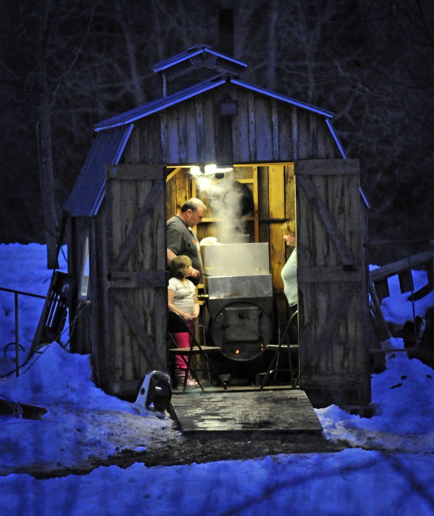
Justin and Joanne Page and their daughter, Aleah, 5, boil sap Sunday evening in the tiny sugarhouse owned by Ronald page on Route 110 in Washington. The Pages tap just under 100 trees and make about 15 gallons of syrup on a good year.
There’s a flood watch out across most of Vermont - the part south of Route 2 - due to rain and melting snow. We’re looking at warm weather to the weekend, when it will likely cool back down to more seasonal temperatures.
Today: Rain, tapering to scattered showers late in the day. Highs 46-51. South wind 10-15 mph with a few gusts to 30 mph over the Greens through midday, diminishing to less than 10 mph by early afternoon, light and variable by late afternoon.
Tonight: Scattered rain showers tapering to a few wet snow showers before ending. Partial clearing late. Lows near 30. Wind shifting to West 10 mph or less.
Wednesday: Partly cloudy. Slight chance for late PM rain or wet snow showers. Highs 40-45. West to southwest wind 5-15 mph.
Extended Forecast:
Wednesday Nt: Becoming mostly cloudy, isolated snow showers. Lows 20-25.
Thursday: Mostly cloudy, breezy, chilly, widely scattered snow showers or flurries. Highs 30-35.
Thursday Nt: Decreasing clouds, widely scattered evening flurries. Lows 15-20.
Friday: Mostly sunny, breezy. Highs 32-37.
Friday Nt: Becoming mostly cloudy. Slight chance for flurries. Lows 20-25.
Saturday: Mostly cloudy, chance for wet snow showers. Highs 35-40.
Forecast Discussion:
A dilatory, wavy cold front just reaching the western Adirondacks as of mid-morning will wiggle eastward today, preceded by a swath of rain. It looks like a moderate rainfall is in the works: somewhere between .40” and .80” with local 1.00+ amounts along the spine of the Green Mountains will likely fall before steady rain tapers to showers west of the Connecticut Valley towards sunset, and over New Hampshire early tonight with the passage of the front. There may be a few wet snow showers before all activity ceases later tonight. Tomorrow, a slot of dry air and narrow surface ridging should provide at least some breaks in the overcast if not a period of partly sunny conditions before the upper level trough lagging the surface cold front approaches with its own batch of moisture. By then, the temperature aloft and at the surface will be cold enough to support snow showers. These will continue on and off through Thursday—mainly over mountainous terrain of northern Vermont-as the trough deepens over us, a surface LOW strengthens over New Brunswick, and a cyclonically curved northwest flow increases. The much above normal temperatures will be replaced with readings at or below seasonal norms for the second half of the week through the weekend.