
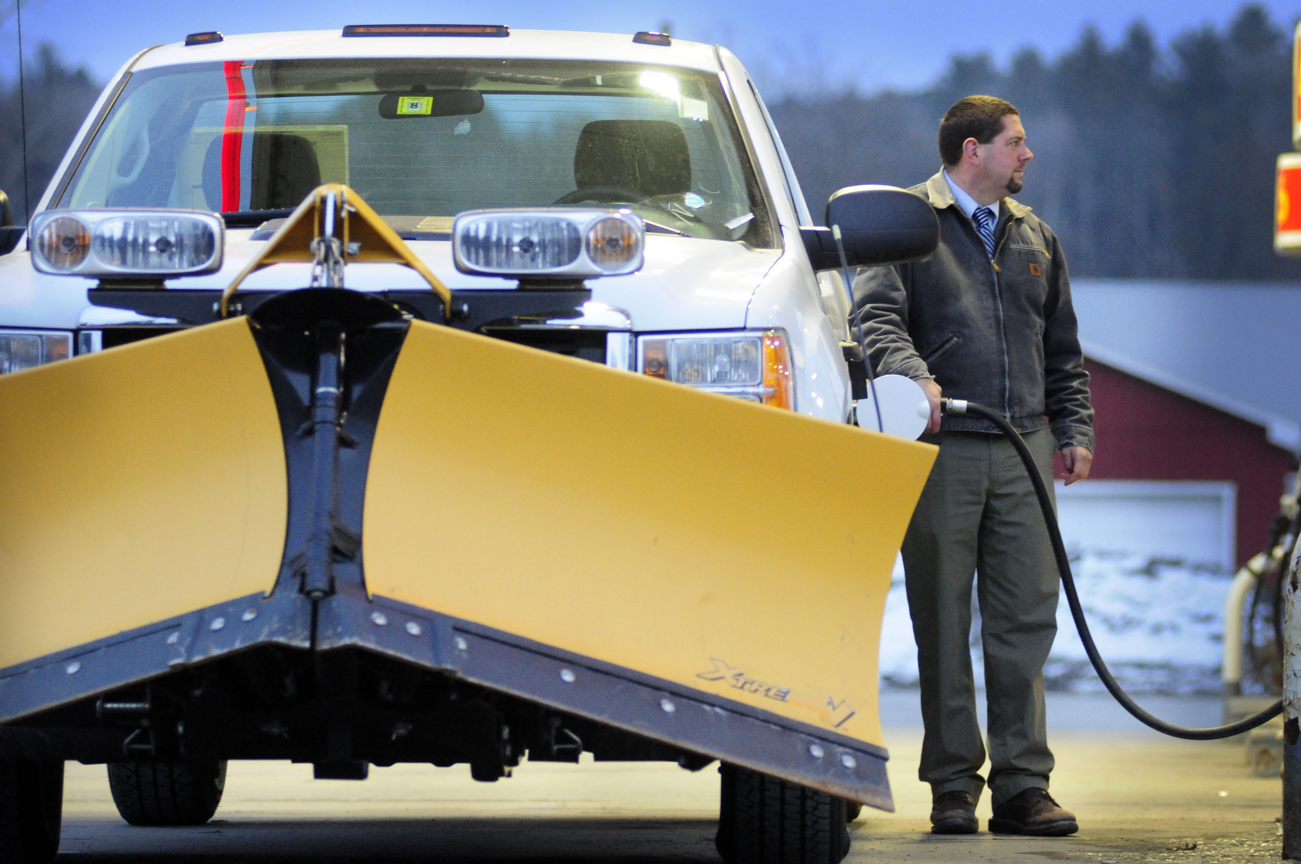
Capitol City Buick GMC salesman Burton Spooner III fuels up a 2013 GMC Sierra plow truck Monday evening at Kurrle Fuels in Montpelier in preparation for a winter storm forecast to begin early Tuesday and continue until Wednesday morning. Spooner said he likes plowing, but is not looking forward to the task of helping to sweep snow off about 300 vehicles at the Berlin dealership.
The snow has arrived, but according to spotter reports so far, not in the giant amounts promised by some of the TV weather networks. The totals on the NOAA spotter network say between 2 (Bristol) and 4 (Springfield) inches have fallen, with more coming. Here in Rutland it’s hard to tell, because the wind has drifted the snow and scoured parts of the ground clear.
There are plenty of school closings, though, from north to south. Click here to see the list on VPR.org.
Here’s the forecast from the Fairbanks Museum in St. Johnsbury:
Today: Snow, moderate at times through midday, then tapering to snow showers late. Snow may be mixed with sleet or rain at times just west of the Green Mountains. Highs 30-36. SE wind 8-15 mph east of the Green Mountains, and 10-20 mph with gusts to 40 mph over and west of the Green Mountains during the morning, becoming East and diminishing to less than 10 mph by late afternoon. Total snow accumulation 3-7” along the RT 7 corridor, and 8-14” elsewhere; up to 8 inches north and east of I-89.
Wednesday: Partly to mostly cloudy, scattered snow showers. Highs 32-38. West wind 10-15 mph.
Extended Forecast:
Wednesday Nt: Variable clouds, widely scattered snow showers or flurries. Lows 15-20.
Thursday: Partly cloudy, scattered snow showers. Highs 28-33.
Thursday Nt: Becoming mostly cloudy, scattered snow showers. Lows 15-19.
Friday: Partly to mostly cloudy, widely scattered flurries. Highs 32-37.
Friday Nt: Partly cloudy. Scattered flurries. Lows 19-24.
Saturday: Partly sunny. Highs 35-40.
Forecast Discussion:
Old Man Winter is going down swinging. On the last full day of the calendar season, a major snow storm is in progress over New England, including Vermont. Complex LOW pressure with one center near western Lake Huron and another developing near New Jersey will pump moist air over a stubborn wedge of polar air- locked in place by HIGH pressure over eastern Quebec—through tonight. Snow totals by tomorrow morning will likely run 6-12” on valley floors, and 10-18” over higher ridgelines. One surge of snow this morning, with greatest amounts over southern and central Vermont, will give way to a midday lull as energy transfers from the LOW over the Great Lakes to the developing coastal LOW. Then another surge will descend from late afternoon through about midnight, focused over northern Vermont as the coastal LOW takes over and throws Atlantic moisture over us. Unsettled weather will continue Wednesday through Friday with frequent snow showers on Wednesday gradually winding down to scattered flurries by Thursday and Friday. Temperatures will run below normal.